Geospatial Data Science
I have worked on many data science projects for processing Earth geospatial datasets with statistical and machine learning algorithms
Image cube segmentation to track commodity expansions
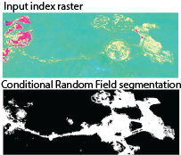
At the start-up Sust Global, I developed machine learning classification and segmentation algorithms for tracking mining activity. Such data products will help companies track the activity at mining sites.
Real-time Tracking Anthropogenic Gas Emissions
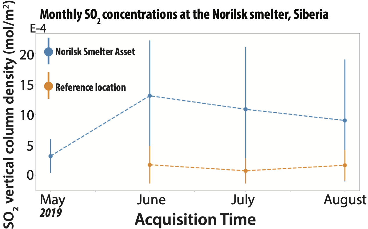
At the start-up Sust Global, I developed statistical algorithms for processing Sentinal-5 and OCO-3 gas emissions data. Such data products will help companies track the activity and pollution of industry sites.
Other projects
I am a collaborator on the Schmid Academy project, WISER Software Toolkit for Imaging Spectroscopy Visualization and Analysis. I also work on various Caltech collaborations for analyzing treating geospatial image cubes with state-of-the-art statistical and machine learning techniques.